
Circular Hike Around the Roques de García
The Roques de García rock formations in Teide National Park are among the most popular hikes on Tenerife – and for good reason: the circular trail is easy to walk and still incredibly impressive.
- Official hiking trail “Sendero 3”
- Starting point: Mirador de la Ruleta (large car park)
- Drive from Garachico: approx. 80 minutes
- Distance: 3.5 km (approx. 2.5 hours)
- Elevation difference: approx. 200 metres
What to Expect
There are places that look as though someone has built a film set in the middle of nature. The Roques de García in Teide National Park are exactly that kind of place: bizarre rock formations rising from a vast volcanic plateau, the mighty cone of Mount Teide towering behind them, surrounded by shades of red, ochre, black and white that almost seem unreal.
Despite the dramatic scenery, you don’t need to be an experienced hiker to enjoy this landscape. The circular trail around the Roques de García is only around 3.5 kilometres long, with little elevation gain and no technical difficulty. A good footing is all you really need.
Getting There from Garachico
From Villa ARTE in Garachico, you can reach the Roques de García in around one and a half hours. The route first follows the TF-82 uphill through Santiago del Teide, before joining the TF-38 through the pine forests of the Corona Forestal and into Teide National Park – a completely different world. The landscape becomes more barren, the scenery increasingly dramatic, and Mount Teide seems to grow closer with every kilometre.
You’ll pass the Mirador de las Narices del Teide viewpoint (well worth a stop for photos), then turn left at Boca Tauce onto the TF-21, following the road through the vast Cañadas. After just a few kilometres, the striking rock formations come into view. Parking is available directly at the Mirador de la Ruleta.
Alternatively, you can reach Teide National Park from the north via La Orotava, driving through the impressive pine forests of the Corona Forestal. This route is slightly longer and more winding, steadily climbing higher into the mountains – but equally spectacular. It also makes a wonderful return route, gradually leading you back down towards the coast.

Füge hier deinen Tooltip-Text hinzu
Tip: Parking at the Roques de García can be challenging. This area is one of the most visited spots in the entire national park. From around 9 a.m. onwards, parking spaces become scarce and some patience is required. Arriving around 8 a.m. is far more relaxed – or, in summer, later in the afternoon from around 4 p.m.
Is the Circular Walk Around the Roques de García Worth It?
Absolutely. The Roques de García are considered one of Tenerife’s most important natural monuments for good reason. The famous Roque Cinchado – often called the “Finger of God” or “Stone Tree” – once appeared on the Spanish 1,000 peseta banknote. Together with Mount Teide rising behind it, it remains one of the most photographed landscapes on the island.
Don’t let the crowds around the car park put you off. Most visitors stop only briefly at the Mirador de la Ruleta viewpoint for the obligatory photo before moving on. After just a few minutes on the trail, things become noticeably quieter. That’s when the real experience begins: an almost otherworldly landscape stretching across the vast Ucanca plain, past ancient lava flows and bizarre rock formations that seem to belong to another planet.
Weather and What to Bring
Don’t underestimate the altitude here: you are hiking at around 2,200 metres above sea level. Even if the sun is shining in Garachico and temperatures are a pleasant 20°C, conditions at the Roques de García can feel surprisingly cool – or unexpectedly hot. Temperatures vary greatly depending on the season and time of day.
In winter, temperatures on the plateau can drop to freezing point. Snow is not uncommon, and strong winds are frequent. Warm clothing and a windproof jacket are essential.
In summer, the sun at this altitude can be intense, much like in the Alps. UV radiation is significantly stronger than on the coast, and there is very little shade along the route. Avoid hiking during the hottest midday hours and make sure to drink enough water.
All year round, sturdy footwear is important, especially for the gravelly descent into the Ucanca plain and the short final climb. Trainers may work in dry conditions, but hiking or trekking shoes are the better option. Bring sufficient water, as there are no refreshment stops along the route (apart from the café at the Parador Hotel near the start and finish point). Sun protection, a hat and sunscreen are recommended at any time of year.


We recommend walking the circular route clockwise (first along the Roques, then descending into the plain). This way, the steeper climb comes at the end – walking downhill on loose gravel is usually more demanding than going uphill.
The Hike in Detail
Starting at Mirador de la Ruleta
The walk begins at the Mirador de la Ruleta viewpoint, directly opposite the Parador Hotel. Even here, the scenery is breathtaking: before you stretches the vast Ucanca plain, dominated by the mighty rock formation La Catedral. Rising up to 200 metres high, its prism-like shape almost resembles a giant cathedral. A little further north stands the slender Roque Cinchado – the famous “Finger of God” – with Mount Teide towering in the background.
Following the Roques towards the Northwest
A wide path, initially bordered by wooden walkways and ropes, leads northwest directly towards Mount Teide. The monumental rock formations of the Roques de García accompany you on the left-hand side. You pass close to Roque Cinchado before continuing along a line of striking volcanic formations: Roques Blancos, El Burro and Torrotito – each with its own unique shape, colour and character.
The path remains easy at first, then gradually becomes narrower and slightly rockier. As you round the bright rock formation Torre Blanca, the landscape suddenly opens up into a spectacular panorama: the entire Ucanca plain lies at your feet, the largest sediment basin in the national park.
Descending into the Ucanca Plain
Now begins the most scenic section of the hike. A narrow, partly gravel-covered path leads down into the western caldera. On your left, you’ll spot the fascinating lava tongue known as La Cascada – a frozen lava flow that resembles a stone waterfall. The colours of the volcanic rock are extraordinary: black, rusty red, ochre and white blend together, crossed by dark mineral lines.
Passing La Catedral
At the lowest point of the route, you stand directly beneath the enormous volcanic dome of La Catedral. Up close, the formation appears even more impressive than from afar: a former volcanic cone, sculpted by erosion into striking prism-like structures. Huge rock fragments have broken away over time and now lie scattered at the foot of this giant.
The Final Climb
Behind La Catedral begins the final stretch: a short but fairly steep ascent over the mountain saddle back towards Mirador de la Ruleta. This is the most demanding part of the hike, but it’s quickly completed. Your reward is one last magnificent view over the entire route before arriving back at the starting point.
Alternative Route
Instead of starting at Mirador de la Ruleta, you can also park at the Llano de Ucanca Vista Point and approach the rock formations from the Ucanca plain. From there, the trail leads directly to La Catedral before joining the circular route and returning to the viewpoint. This beautiful alternative adds around one extra hour to the hike – though the small viewpoint car park only has space for around ten vehicles, so a bit of luck is required.
Geology and Flora to Marvel At
The Roques de García are far more than just rocks. They are a geological window into Tenerife’s ancient past — up to 1.7 million years old and therefore significantly older than today’s caldera plateau. The Las Cañadas caldera itself is a gigantic collapse crater formed by the collapse of a predecessor volcano. Geologists still debate the exact cause: was it a massive landslide, the collapse of an emptied magma chamber, or a combination of both? One thing is certain: the Roques de García mark the boundary between the two halves of the caldera. While the ground on both sides sank deeper into the earth, the current crater floor gradually filled with countless lava flows over thousands of years and now lies around 500 metres above the original caldera floor.
At first glance, the landscape may seem barren and lifeless. But look more closely and you’ll discover surprisingly diverse vegetation along the trail — including several endemic species found nowhere else in the world. The dominant plant around Mount Teide is the hardy Teide broom shrub. The true highlight, however, is the famous red tajinaste, known locally as Tajinaste rojo. This spectacular wildflower can take three to five years to bloom, producing striking crimson flower spikes up to three metres high before dying afterwards. If you visit in May or June, you may be lucky enough to witness the mountainsides glowing in vibrant red. Between the rock formations of the Roques, small groups of Canary Island cedars and Canary pines also grow — ancient tree species perfectly adapted to drought and extreme temperature changes.
If you stay until the evening: Teide National Park is one of the best stargazing locations in the world. On clear nights, you can see the Milky Way with the naked eye.
Extension Option #1: Deeper into the Ucanca Plain
From the lowest point of the circular trail, you can take a detour into the vast Llano de Ucanca — the largest sediment plain within the caldera. Here you’ll find the curious rock formation known as Zapato de la Reina (“The Queen’s Shoe”), which really does resemble the shape of a shoe. According to a Guanche legend, a princess of Tenerife’s indigenous people once lost her shoe here — and ever since, it has remained in the middle of the Cañadas. The plain feels especially surreal during the winter months, when rainfall creates temporary shallow lakes that beautifully reflect Mount Teide.
Extension Option #2: Los Azulejos
Just about one kilometre south of the Roques de García, along the TF-21 towards Boca de Tauce, lies another geological wonder: Los Azulejos. These colourful rock formations shimmer in shades of turquoise, jade green and purple — their name inspired by the traditional ceramic tiles (“azulejos”) commonly found across the Iberian Peninsula. The colours were created through hydrothermal processes: rising water deposited iron hydroxide into the rock, creating this unique palette. In bright sunlight, the colours appear particularly vivid. Los Azulejos can easily be admired from the road, and there is a small parking area perfect for a short stop on your way back.
Extension Option #3: Combine Hiking Trails
Ambitious hikers who find the Roques de García loop too short have direct access from the main parking area to several additional marked trails within Teide National Park. One popular option is the approximately five-kilometre-long Sendero PNT 19 “Majúa”. Alternatively, you can drive a few kilometres further north and hike part of the roughly seven-kilometre-long Sendero PNT-39 towards Montaña Blanca. Another highly recommended route starts at the Portillo Visitor Centre: the eight-kilometre circular trail PNT 02 Arenas Negras. You’ll find detailed information on the official TenerifeON website — and be aware that some trails may occasionally close during mouflon control operations.
Looking for a perfectly located place to stay for your Tenerife holiday? Discover Villa ARTE in Garachico!
Five Exclusive Apartments
Instead of anonymous hotel resorts, the five apartments at Villa ARTE offer the perfect combination of comfort and the charm of a historic building. Villa ARTE is located right in the heart of Garachico, just a few steps from the natural lava pools of El Caletón, the Atlantic Ocean and the historic old town. One of the highlights is the large panoramic rooftop terrace with views over the sea and the town.
Garachico is an ideal base for exploring Tenerife, especially for hiking enthusiasts. Both Teide National Park and the Anaga Mountains can be reached within 60 to 90 minutes via well-maintained roads. The town itself offers everything you need for a relaxing holiday while remaining peaceful, authentic and free from mass tourism or party crowds.

- Sustainable, healthy construction
- Spacious layout
- Fully equipped kitchen
- Separate drinking water tap – no need to carry plastic bottles
- Many restaurants within walking distance
- The most personalised booking service
- Early-bird benefits
- Welcome basket with organic products
- Private guided tour of Garachico
- Loyalty bonus for returning guests
Enjoy the benefits of booking direct
When you book directly with Villa ARTE, you benefit from exclusive advantages that make planning your holiday easier and your stay even more enjoyable.
Ático Exclusivo
- Size: 60 m²
- Floor: 1st
- Guests: ~4
- Outdoor: 2 Terraces


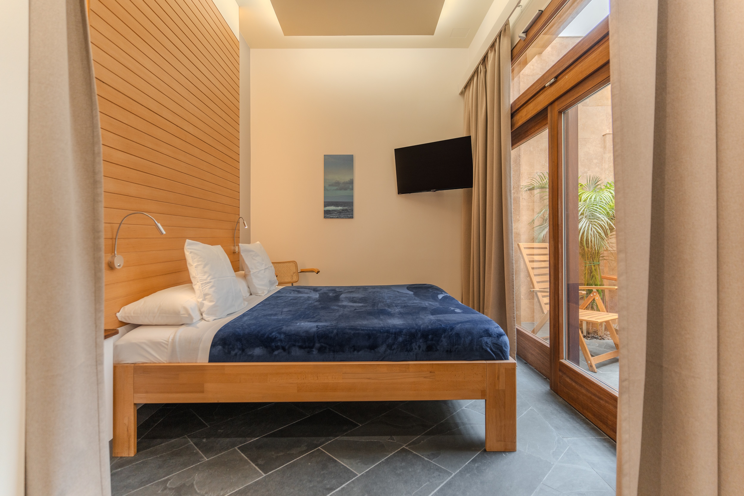
Suite Azul
- Size: 44 m²
- Floor: Ground floor
- Guests: ~2
- Outdoor: Patio

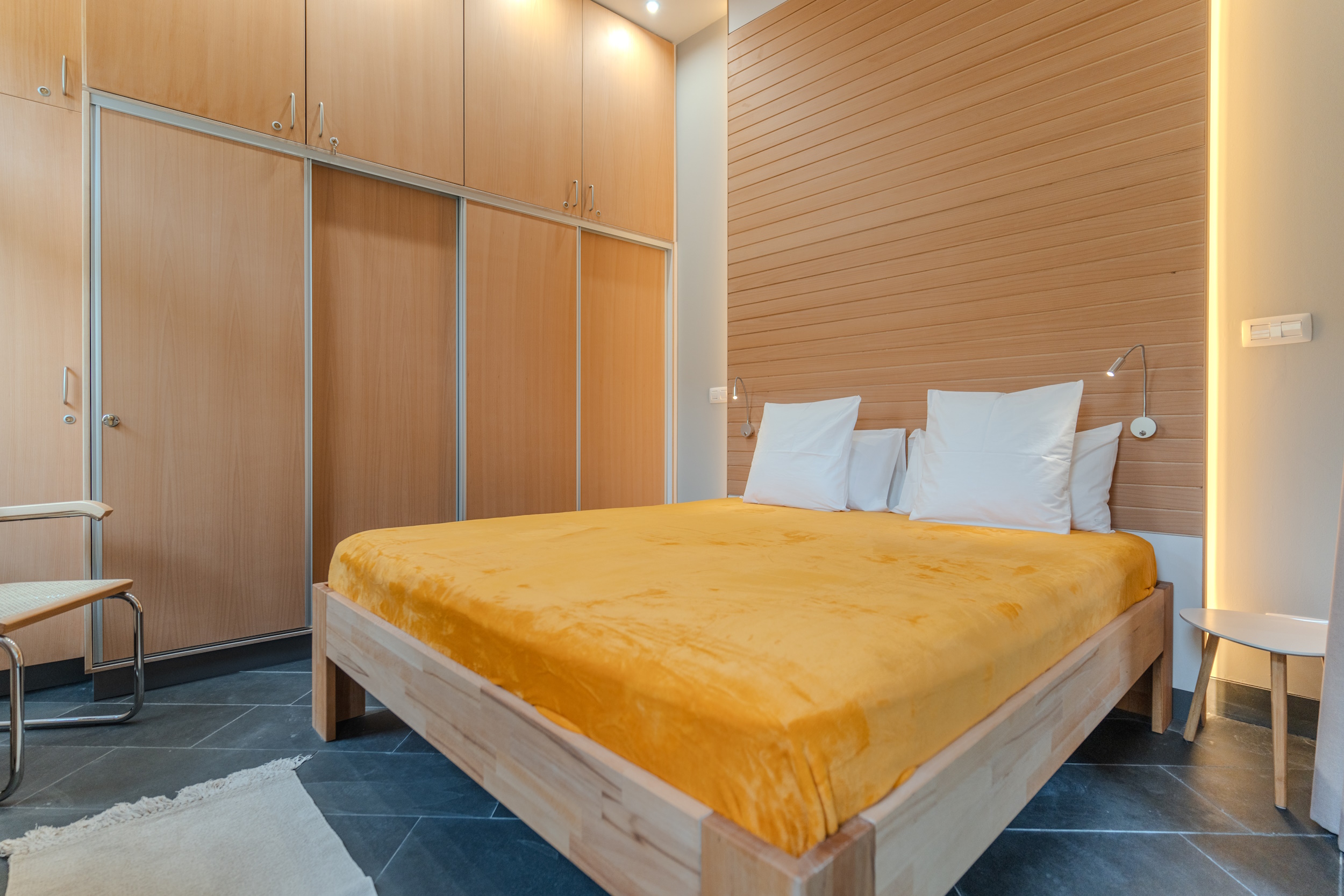
Apartamento Amarillo
- SIze: 59 m²
- Floor: 1st
- Guests: ~4
- Outdoor: Balcony